Despite Polar Vortex, Mega New Line Skied on B.C.’s Thor
The remote range is popular for local backcountry skiers
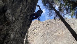
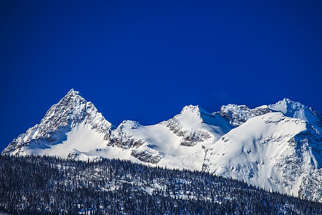 Photo by: Murray Foubister of Odin/Thor group
Mount Thor is one of the tall peaks that rise west of Shelter Bay south of Revelstoke. The granite peaks in the area are some of the finest in central B.C. and hold many new ski and climbing lines for those in seek of adventure.
Canada has a number of peaks named Thor, including one in the nearby Selkirk Range and the famous Thor on Baffin Island. The Thor in the Monashees is one of the lesser known Thors.
During the recent Polar Vortex in B.C. with temps dipping to minus 40 degrees Celsius, Christina Lusti and Andrew McNab made the first ski descent of the South Face of Thor via a 1,500-metre 45 to 50 degree line.
Thor is part of the Gold Range, which is a subrange of the Monashee Mountains in the southern B.C. Interior. This range applies to a narrow stretch of the Monashee Mountains’ eastern flank adjoining Upper Arrow Lake, west of the upper Shuswap River. Other peaks include Odin, Niflheim, Laag, Gunnarsen, Burnham, Cranberry, Blanket, Huges and Gates.
Lusti and McNab were recently joined by Brette Harrington for the first descent of the Gold Card Couloir M4+ WI4 C0 60° 800m, read more about it here. Last February, Lusti and McNab made the first descent of a line on Mount Macdonald in Rogers Pass, read about it here.
Thor History
The first ascent of Thor in the Monashees was in the mid-1960s. D. Parfitt of the Apine Club of Canada wrote about the climb in the 1967 Canadian Alpine Journal:
Mount Thor. A party led by me succeeded in the first ascent of this major peak in the Gold Range of the Monashees on August 7. Other members of the party were Graham Hollins, Chris Kopczynski and John Roskelley. Our approach was from the northeast via logging roads from Sidmouth to the vicinity of Pingston Creek, to a point ¼ mile east of the low point on the road to Coursier Lake. Earlier, we had established a trail southeast from this location, bridging Pingston and Thor Creeks.
We followed this trail and then proceeded into the basin between the northeast and northwest ridges of Mount Thor, where we bivouacked at 7400 feet. The next morning we climbed a snow slope to a col at 8100 feet, then proceeded southeast up a rock ridge and down its far side to a col at 8350 feet below the summit ridge of Thor. After crossing to the top of a snow- field, we ascended the ridge, which proved a fairly steep scramble on solid rock. Some belaying was required but pitons were not used. The total climbing time from the road was 10¼ hours for the ascent and 5½ hours for the return.
Check out the latest buyer's guide: