Climbers Rescued off Mount Logan

Three climbers who were attempting the East Ridge of Mount Logan are safe in Haines Junction after being rescued.
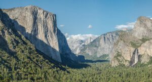
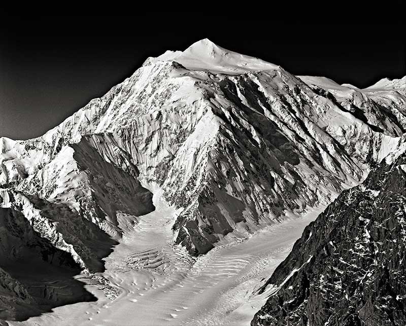
Mount Logan, located in Kluane National Park, is Canada’s highest mountain at 5,959 metres, less than 200 metres shorter than Alaska’s Denali.
The rescue was conducted by the highly trained Visitor Safety members and pilots of Kluane National Park and Reserve with the support of the Mountain Block Parks (Jasper, Banff/Yoho/Kootney, Glacier, Waterton) and the U.S. NPS Rangers.
The company called Icefield Discovery had flown the climbers to the East Ridge of Mount Logan three weeks ago.
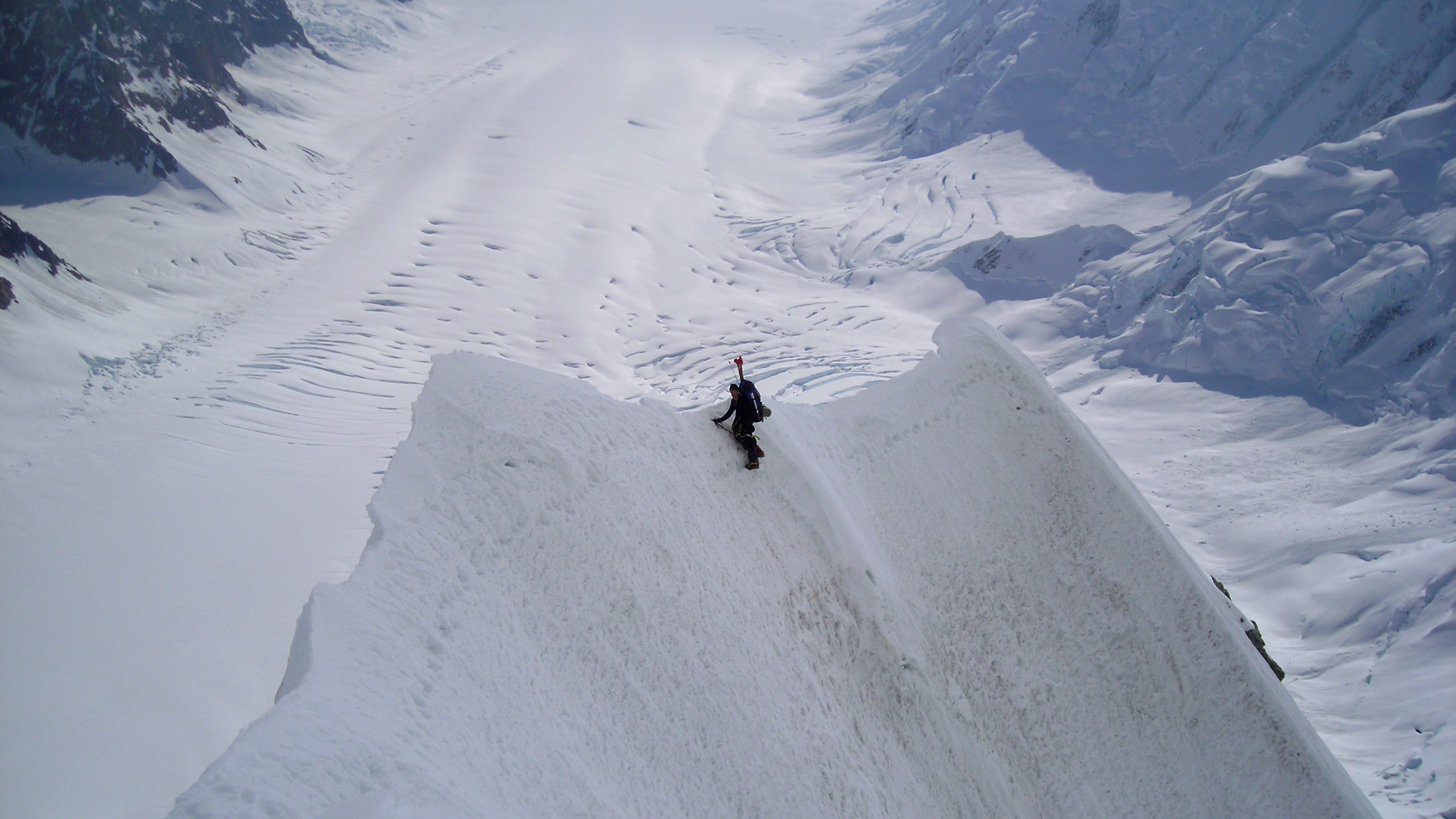
The rescuers made three round trips in a AS350 B3 helicopter from a staging area near the base of Mount Logan to the extraction point around 5,300 metres.
Two climbers had been on Mount Logan recently and one had recently made a trip to Alaska’s Ruth Gorge where he made a number of successful ascents of big objectives. They were rescued on the descent from the summit of Mount Logan.
The East Ridge
The East Ridge was first climbed in 1957 by the America team of Don Monk, Gil Roberts and three others and they reached the summit on July 19.
The second ascent was by an all-Canadian team and was guided by the famous guide, Hans Gmoser.
In the 1960 American Alpine Journal, Hans Gmoser wrote about the team’s second ascent of the East Ridge. Here is that article:
On June 12 an all Canadian party made the second ascent of Mount Logan’s east peak by the route first made in 1957 (A.A.J., 1958, 9:1, pp. 31-38). Our party consisted of Willy Pfisterer, guide, Phil de la Salle, Ron Smylie, Don Lyon, Karl Rickmer and Hans Gmoser, guide. Pfisterer and Smylie drove our equipment to Whitehorse while the rest of us hitch-hiked.
From Whitehorse we drove to Kluane Lake. After making two airdrops on the east side of Mount Logan and dropping three two-man rubber rafts on the tongue of the Donjek Glacier, Rickmer and I proceeded from the south end of Kluane Lake up Slim’s River to catch our friends who had started a day ahead of us. After a day and a half’s travel we got onto the Kuskawulsh Glacier, which we followed to the height of land, where it connects with the Hubbard Glacier.
We continued 15 miles south on the Hubbard and nine miles west on a smaller glacier to reach the foot of the east ridge of Logan. This took seven days; we covered a distance of about 100 miles, carrying all our gear and ten days’ food. After resting two days, we started the climb, taking skis to 8800 feet. On the fifth day we established Camp III at about 16,800 feet. The next day we reached the East Peak of Mount Logan shortly after 1 p.m. in perfect weather.
There was hardly any wind; it was a gift from Heaven. We left Camp III the next morning at eight and reached the foot of the mountain at 2 a.m. After two days of resting, eating and sleeping, we started our return journey. At the turnoff of the Kuskawulsh we kept going north and stayed on the Hubbard until we reached the Donjek Glacier. A
fter four days, we arrived at the Donjek River flats, having covered another 100 to 120 miles. We picked up our rafts with considerable difficulty; one had 96 holes from landing in a tree. With skis and air mattresses we made two small rafts and began our river journey.
A crackup 15 miles later forced four of us to walk, while Pfisterer and Smylie proceeded with one raft and all our equipment. A half mile from the highway all our gear was lost when the raft hung up on a snag. We reached Mile 1128 on the Alaska Highway at 1 A.M., June 22.
Check out the latest buyer's guide: