Free Topos to Tall Ontario Bolted Rock Climbs
Over 30 amazing rock climbs in Ontario's Algoma west of Sudbury on walls over 100 metres high
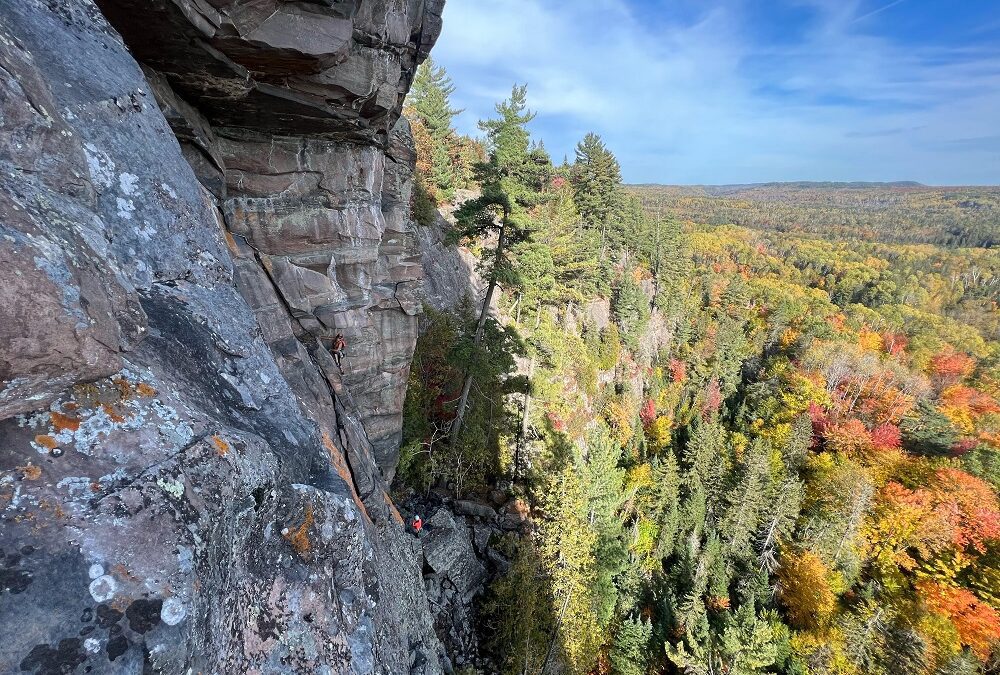
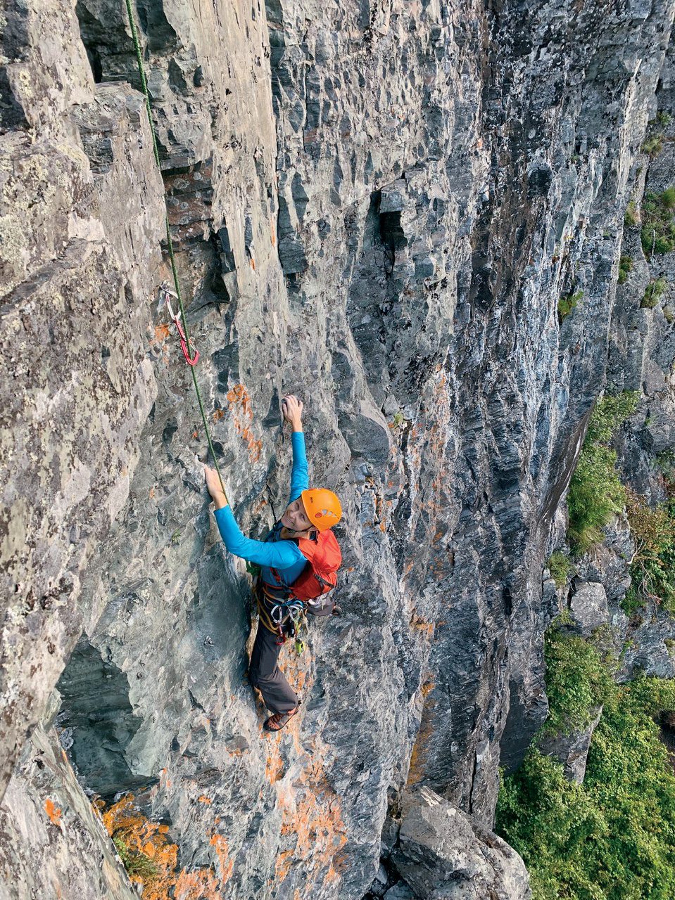
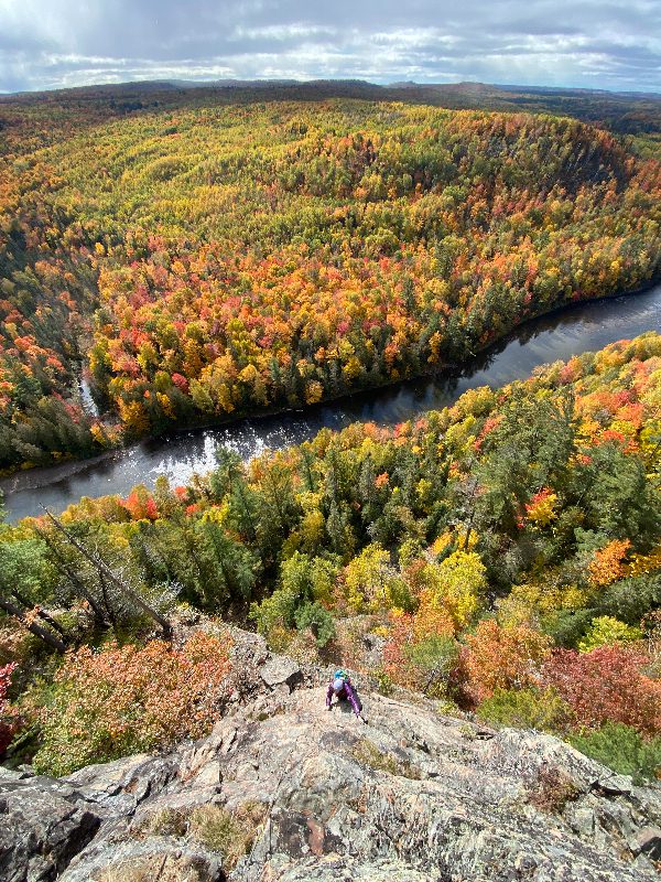
“Beautiful scenery and a tall cliff with multi-pitch bolted routes in a wide range of difficulty. What’s not to like?” says Rafael Kolodziejczyk, one of Riverside’s most tireless developers. After all, there aren’t many fully bolted multi-pitch climbs anywhere east of the Rockies, and especially in the midwest. In the last few years, however, the Little White River Valley, north of Iron Bridge, Ont., has become home to a couple dozen multi-pitch routes ranging from 5.7 to 5.12a. The longest climbs are up to 120 metres in length, and most are four or five pitches long.
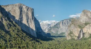
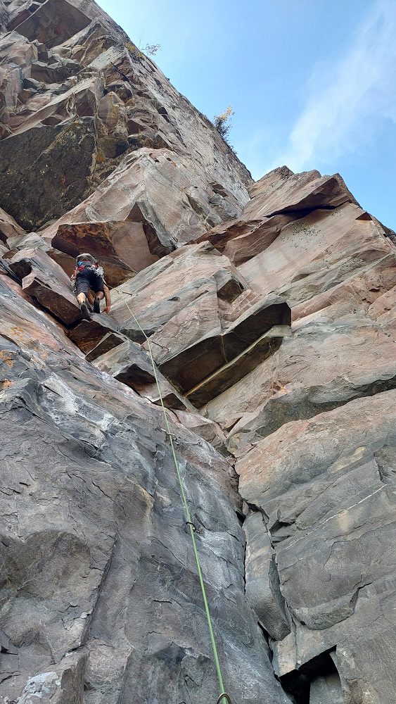
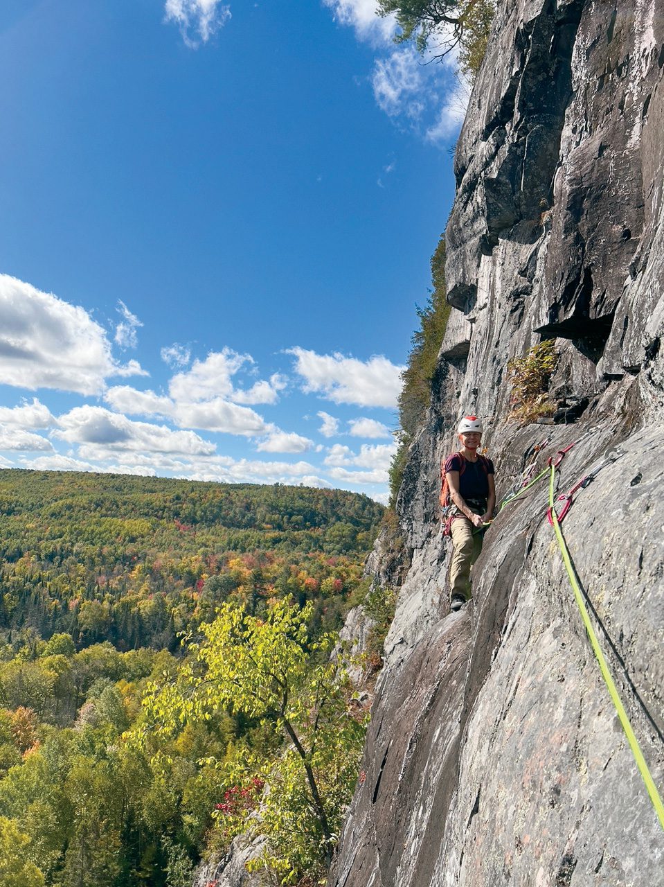
Although the best routes are bolted, the routes could hardly be called sport climbs. Helmets are an absolute necessity, as is checking holds. “I obviously really love climbing up here,” says Rafael Kolodziejczyk, “but it isn’t for everyone. Even the cleanest routes are loose and dirty by the standards of most sport-climbing areas. If you’re looking to ‘send,’ the Red River Gorge is a much better option. If you add a star or two because of the beauty and atmosphere, then I think you’d be more likely to appreciate the area.” In other words, rock quality-wise, think Yamnuska; setting-wise, think a wilderness canoe trip.
Know what route you are on, have an emergency plan and be prepared to bail. Cellphone reception is only available on top of the cliff, and even there, it’s spotty. You will also need to bring in all your food and camping gear. Water from the Little White River needs to be treated. Most climbers will have to pass through the gate at the Brocks’s farm (see “Getting There,” below). You will not be able to get back out via the gate from Friday evening at sunset until Saturday evening at sunset, because the Brocks are Seventh Day Adventists and Saturday is a day of rest. Even if you came in with an all-terrain vehicle, however, help, extra supplies, stores, and other facilities are effectively hard to reach. Self-reliance is key, but for enthusiasts, the remote Algoma setting, the seclusion, and the climbing are more than worth the effort.
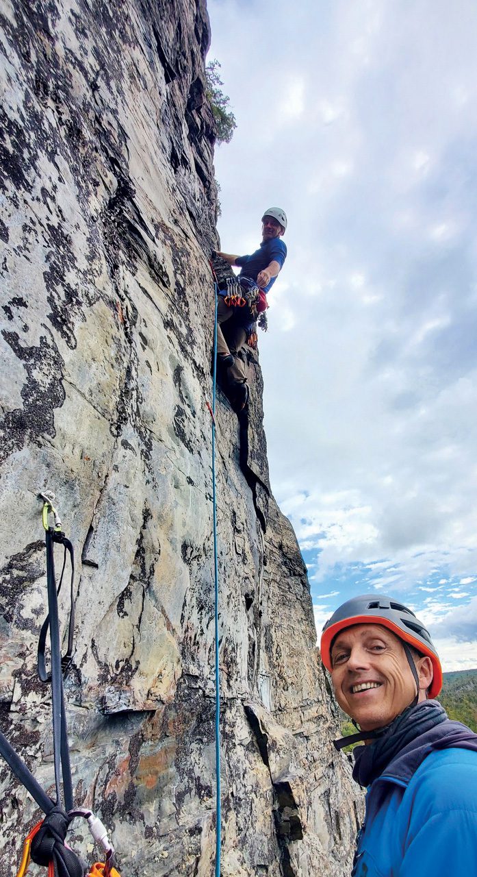
“The best routes are some of the finest I’ve climbed in the east,” says Reg Smart, a Riverside route developer whose 45-year record ranges from an early free ascent of the West Face of El Capitan to opening Lions Head to sport climbing back in the ’80s. “Beauty and the freedom to explore are the things I love most about climbing. The Little White River Valley has lots of rock and extraordinary beauty. It’s my favourite climbing area.”
The Agony and the Ecstasy of Finding Cliffs in Algoma by Danylo Darewych
“I know a cliff three times the size of this one.” Normally I take statements of this sort with a huge grain of salt. Northerners are helpful, but their judgment of cliff height or their perception of what constitutes a climbable cliff or climbable ice can really be off. Often, when I’ve followed their leads, I’ve found only small rock outcrops on tall hillsides or broken rocky jumbles or collections of discontinuous icicles smaller than the ones in my refrigerator.
Moreover, given that we were standing under the 40 metre ice flow of Breaking All the House Rules at Granary Lake, this was a rather bold statement. That would make the proposed cliff 120 metres tall—higher than anything we’d ever seen in southern to mid-Ontario.
However, Mr. Kluding, the man who had uttered the statement, was a rather taciturn individual and not given to exaggeration. He was the owner of the Mountainview Camp cottages where we, the members of the ACC Toronto section, were staying. He had observed enough of our ice climbing shenanigans to know what we were looking for. So, before heading back to Toronto, I popped into his home with a topographic map to get some further information.
“See, it’s right here, north of Kynoch, past our hunt camp on the Little White River,” said Mr. Kluding, pointing at a spot on the map. I glanced at the map and immediately became more interested—many contour lines converged tightly there.
A month later, in March 2013, I was back in Algoma with friends David Broadhead and Josh Burden. Shaun Parent had also come down from Batchawana to join us in Blind River. We were debating where to go climbing, since it was already late in the season and many of the ice climbs we knew in Algoma were south-facing and, as a result, rotting out and falling. Shaun suggested we head over to Intersection Rock or up Highway 129 for a look. Dave, Josh and I hadn`t climbed at either place before at this point, so we readily agreed. We never got to either place that day.
As we were heading towards Highway 129 along Highway 554, I noticed on my map that we would be passing right by Kynoch and recalled my earlier conversation with Mr. Kluding. “Stop! Turn right here,” I told Shaun. “I think there might be something down this road worth looking at. It’s not far and shouldn’t take too long.”
Thankfully, Shaun is never averse to just going for a look. In fact, he’s made a career out of it. He turned off the highway onto the side road. It was not a road I would have driven down otherwise, as it appeared to be just a farm driveway. It led right through the middle of a farm.
Several kilometres further down, the logging road dropped down a long hill and started to run along the Little White River. We started seeing cliffs. The first one wasn’t particularly impressive—it seemed to be about 20–30 metres high, albeit composed of lovely-looking, solid red rock. We made note of some low-angled ice hidden behind the trees on its left bank. Interesting, but not the big cliff the map contour lines seemed to indicate was ahead of us.
We drove on. A couple of kilometres further down the road, a much larger cliff hove into view above the trees. I gazed at it in awe, as it slowly filled the view through the windshield. It towered above the logging road and the river. It looked to be more than 100 metres high. I’d never seen a cliff that high in Southern Ontario. It looked taller than Bon Echo. I couldn’t believe what I was seeing.
Area Details
Getting There: It’s about a six-hour drive from the Toronto or Detroit areas to Riverside, 90 minutes from Sault Saint Marie and two-and-a-half hours from Sudbury. From Iron Bridge, take Highway 546 north from Iron Bridge for 22 kilometres to Brock Road at a collection of houses known as Kynoch. It is often possible for an all-terrain or four-wheel drive vehicle with good clearance to make it from the community centre south of Kynoch to the road to the cliff. Most climbers, however, turn right on Brock Road and drive a kilometre to the gate near the Brock farmhouse. The Brocks are hard working people who like climbers and maintain a shortcut from their property to the logging road where it becomes passable by regular vehicles. They charge $20 to enter and use their road on a one-time basis, or a $250 fee for a year. The Brocks are Seventh Day Adventists, and you can’t get through the gate from Friday sunset to Saturday sunset. When you arrive at the gate, go to the farmhouse and knock on the door to ask to be let through. It is best not to knock on their door after 8:00 p.m. A kilometre past the gate, you are on public lands and may camp, so long as you avoid hunting camps. About five kilometres past the gate is a popular campsite by the Little White River, but the options beyond that are endless.
The Season: The best climbing weather is from July to October. Temperatures are on average a few degrees below those in southern Ontario.
The Bugs: Late April and early May are relatively free from black flies and mosquitoes, but the road is typically only open to ATVs until late May. The black flies at peak season, usually in June, are a round-the-clock, constant pest. By late June, they are dying down, except in the early evening.
Camping and Climbing Gear: You will need to bring all your food and camping gear and water, unless you plan to treat the water from the Little White River. A bug shelter for your campsite will greatly improve your level of comfort in the evening. Bug repellent is a necessity. Bug shirts are popular with some climbers. You will need a 60-metre rope, 25 quickdraws, a few extendable slings and a rappel device, in case you need to retreat.
The Cliffs: Five kilometres from the gate, the Fortress is visible on the left. A few metres along the road, a trail leads to the Ramparts. Seven kilometres past the bridge, you will come to Riverside, an obvious, 120 metre cliff 20 metres from the road.
Descent: For all routes, follow the trail east along the top of the cliff.
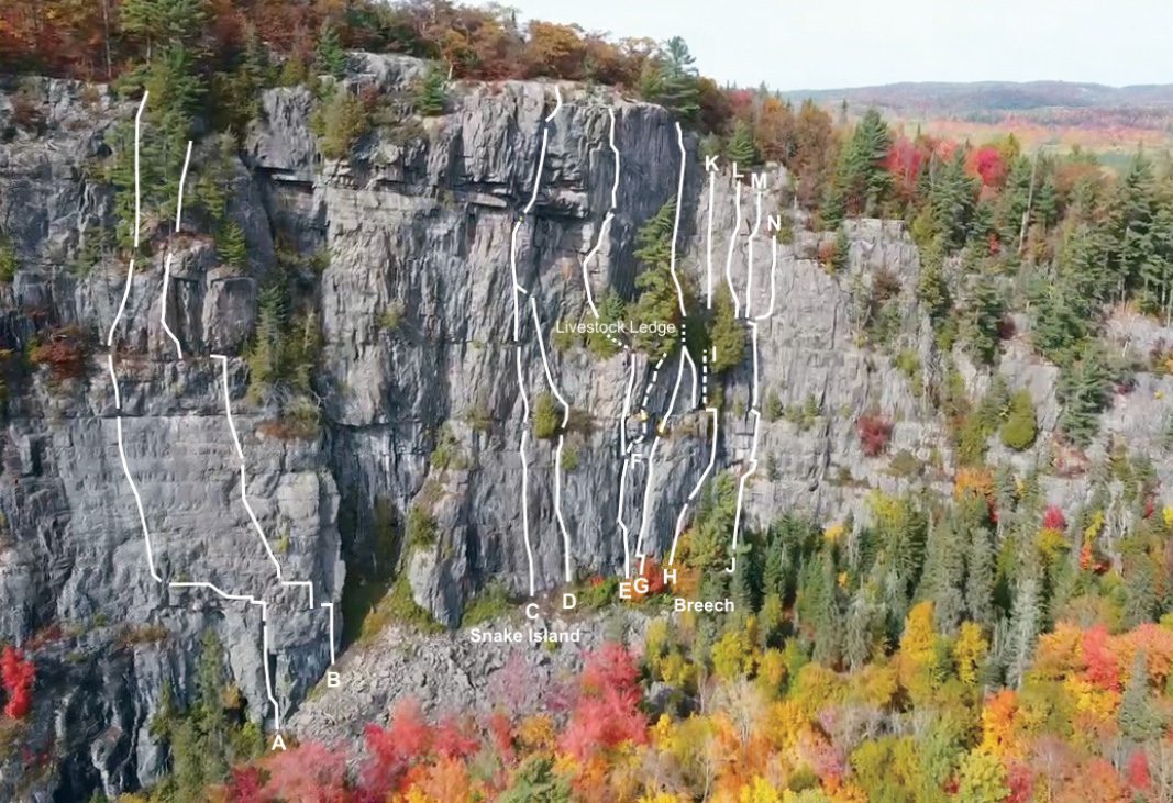
Bullets Wall and North Channel Ledge Topo
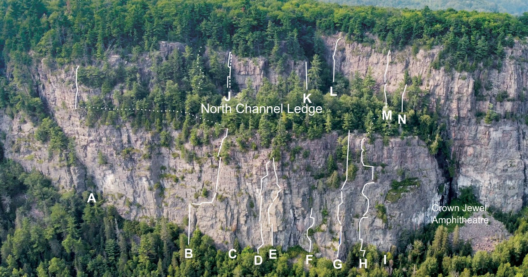
A Nick’s Project
B Bullets Before Breakfast 5.10a, 7p, sport
C War and Peace 5.10b, 4p, trad/mixed
D K-9 High-Step 5.10c, 3p, sport
E Roadblock 5.10a, 4p, sport
F What Rot 5.7 R, 1p, trad
G Danylo’s Delicious, Salty Sausage Dinner 5.8, 3p, trad
H Ancient Epic 5.9, 3p, trad/mixed
I Colin’s Project, sport
J Binary System 5.7 and Binary Direct 5.8 (dashed), both 1p, trad
K Ride a Rubber Gator 5.11, 1p, trad
L Breadcrumbs 5.5, 1p, trad
M Epicurian 5.8, 2p, trad/mixed
N Pyjama Party 5.8, 1p, trad
Lookout Wall Topo
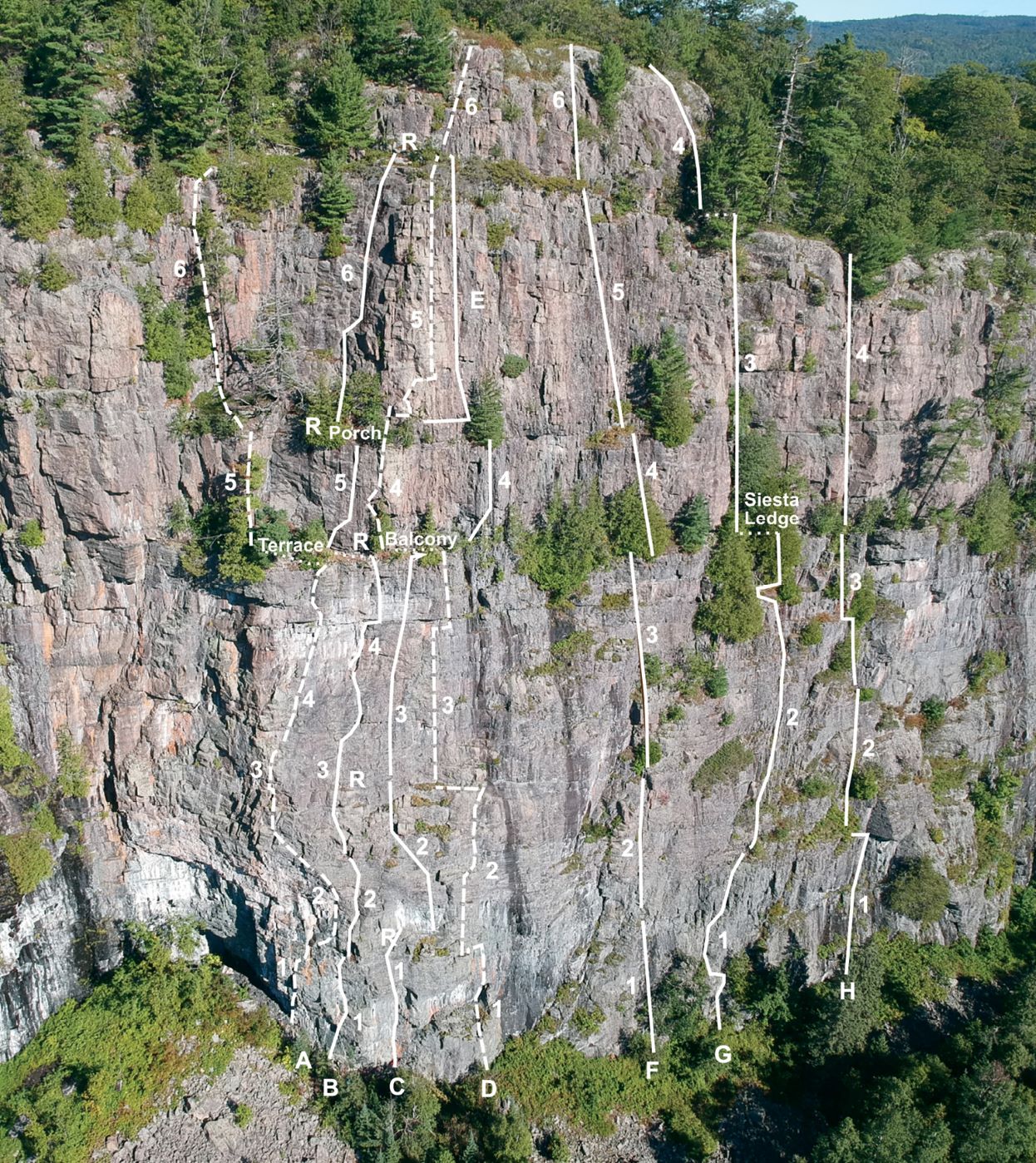
A Kilonova 5.11c, 6p, sport
B The Stars at Night, 5.10b, 6p, sport
C Supernova, 5.11c, 5p, sport
D Full Moon 5.10c, 6p, sport
E Crescent Moon 5.10a, 2p, sport
F Long May You Run 5.10d, 6p, sport
G L.E.A.F. 5.8, 4p, sport
H Uncle Fester 5.9, 4p, 3 sport/1 trad
R (Rappel Route)
Witch Wall Topo
A The Witch 5.11b, 5p, sport
B The Devil’s Work 5.10b, 6p, sport
C Mango Haze 5.12a, 5p, sport
D Serpent 5.12a, 5p, sport
E Rising Ape/Falling Angel 5.12-(?), 4p, sport
F Equine Eructation 5.9, 2p, sport
G Bovine Belching 5.10-, 3p, trad
H Ruminant Regurgitation 5.9+, 3p, trad
I Chewing the Cud 5.10+, 1p. trad
J Out of the Darkness 5.9, 2p, sport
K Dust in the Wind 5.9, 1p, sport
L Pinnacle Pitch 5.10a, 1p, sport
M Wasp Line 5.9, 1p, sport
N Into the Light 5.7, 1p, trad
Ramparts Topo
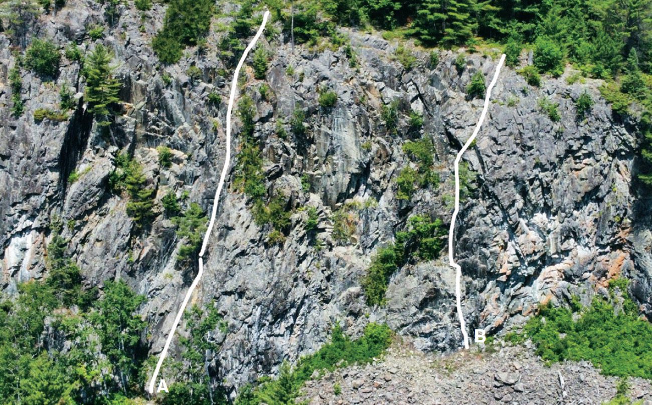
A Approach Shoe Express 5.7, 3p, sport
B Marshmallow Man 5.7, 2p, sport
Out of frame to the right:
Dr. Stoppage 5.10b, 1p, sport
Algoma Gold 5.11a, 1p, sport
This story originally appeared in the April/May 2023 issue of Gripped: The Climbing Magazine
Check out the latest buyer's guide: